 |
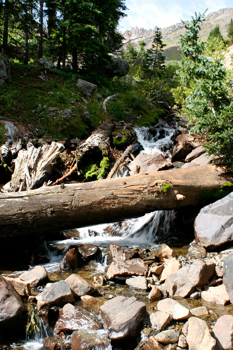
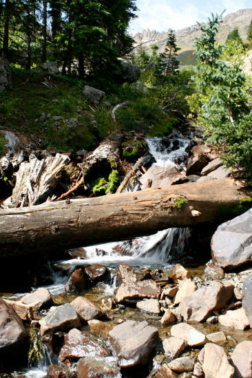
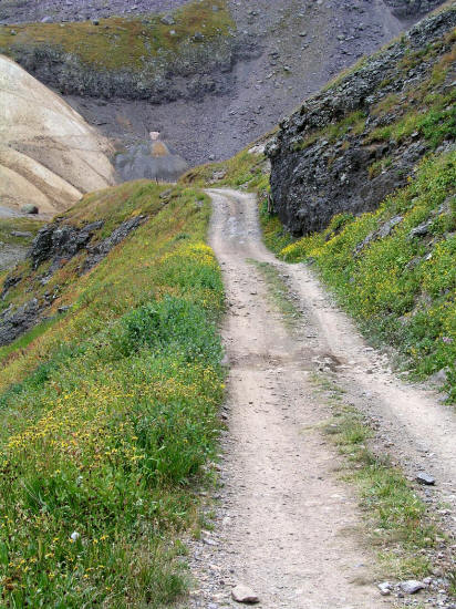
View south at a small drainage from FR 8513C on the climb into Governor Basin.
St. Sophia Ridge can be seen on the horizon.
This is a high clearance four wheel drive only road. All images in this Photo Gallery taken August of 2009.
1
|
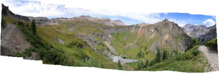 |
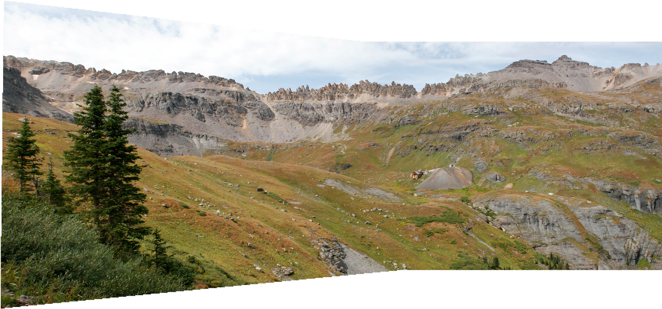
180 degree panoramic view looking generally west above treeline from the Governor Basin access road. The jagged ridgeline on the left horizon is St. Sophia Ridge.
On the right horizon Stony and Teakettle Mountains are clearly visible. An active mine is located in the bottom of Governer Basin. The Mountain Top Mine is center left in the image
on a higher shelf.
2
|
 |
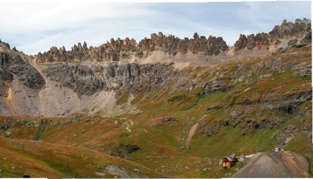
Another panoramic view looking southwest across the basin from FR 8513C. St. Sophia Ridge is clearly visible in this view. The Mountain Top Mine is
center right in the image.
3
|
 |
Cross basin close up of St. Sophia Ridge with the Mountain Top Mine in the lower right corner of the image.
4
|
 |
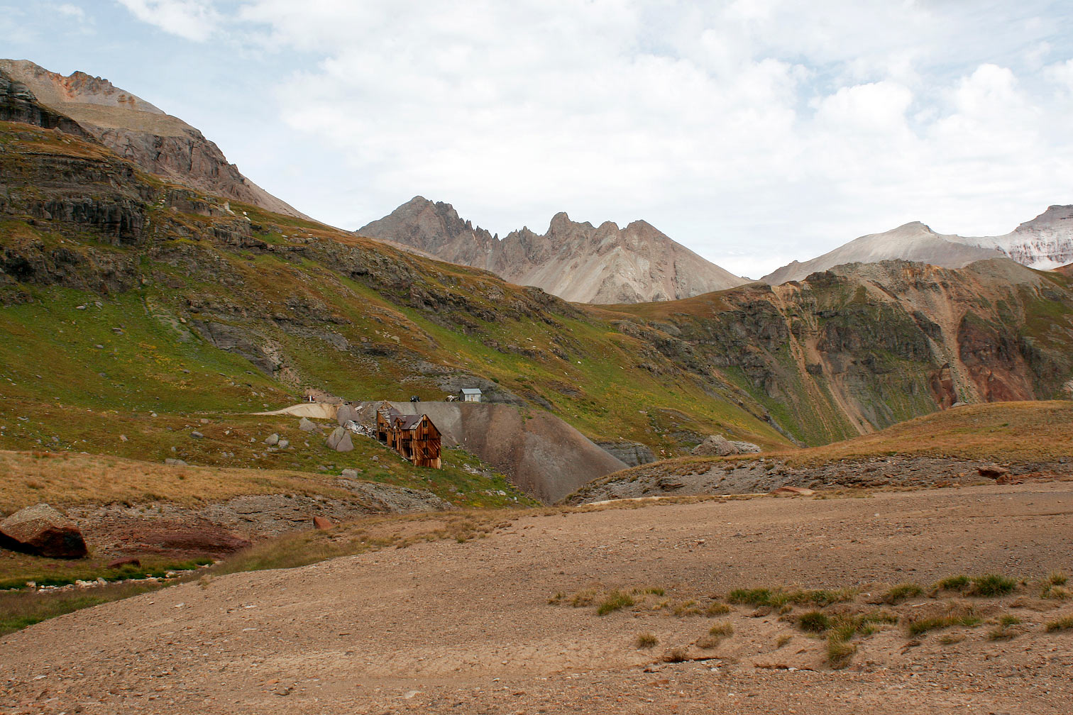
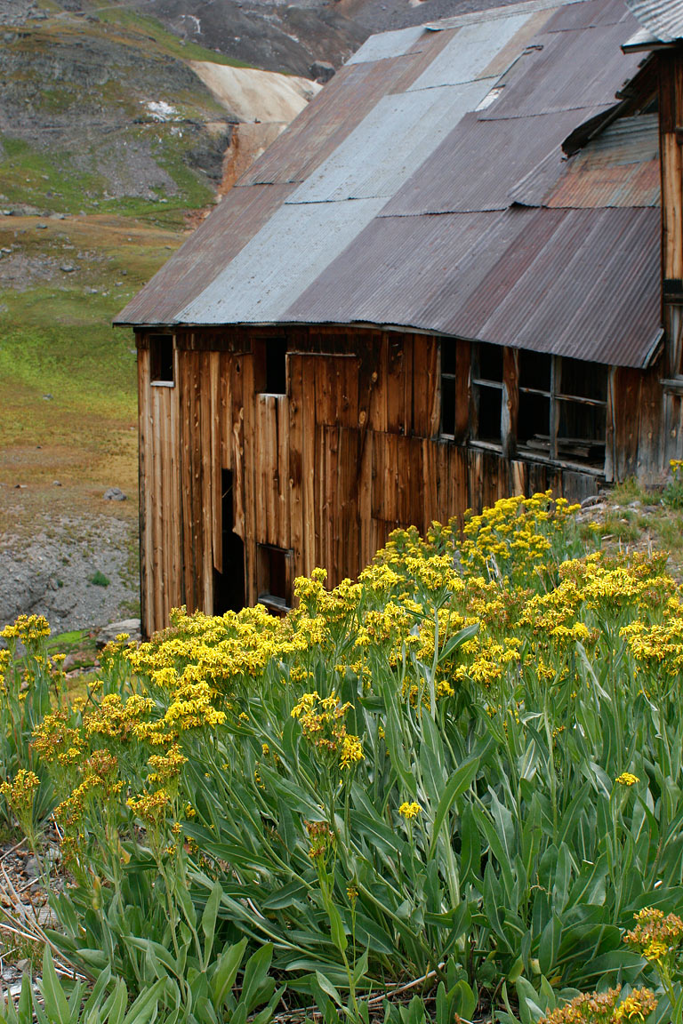
View looking northwest from the access road. Mount Sneffels and Kismet Peak can be seen on the horizon.
5
|
 |
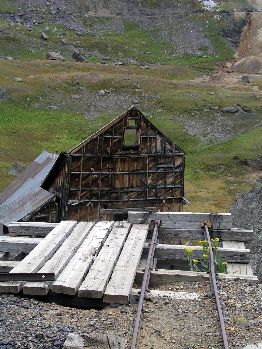
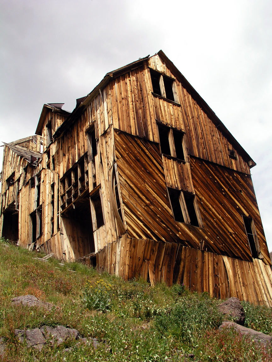
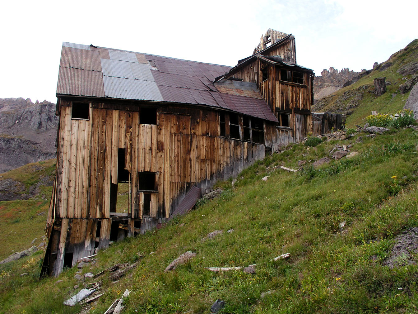
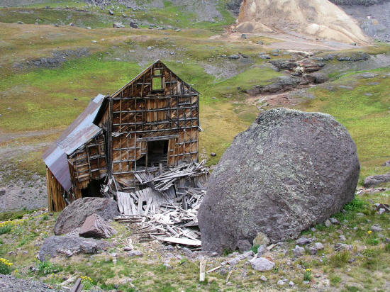
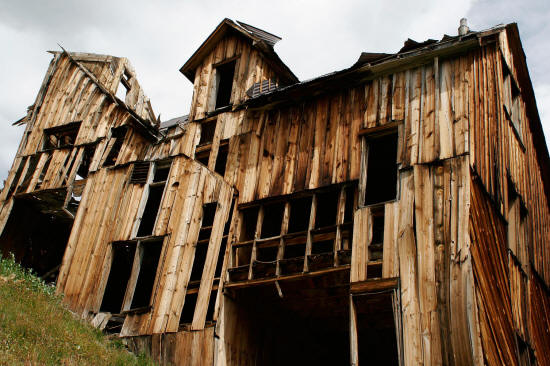
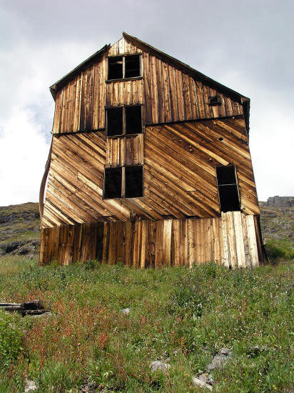
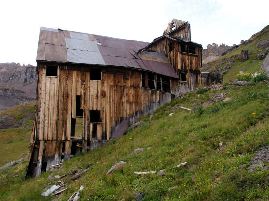
View looking southeast to the northwest corner of the Mountain Top Mine
living quarters and bunkhouse. The building is built on a very steep grade.
6
|
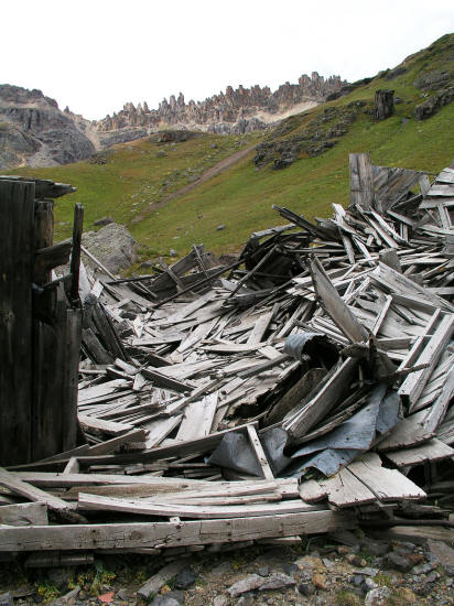 |
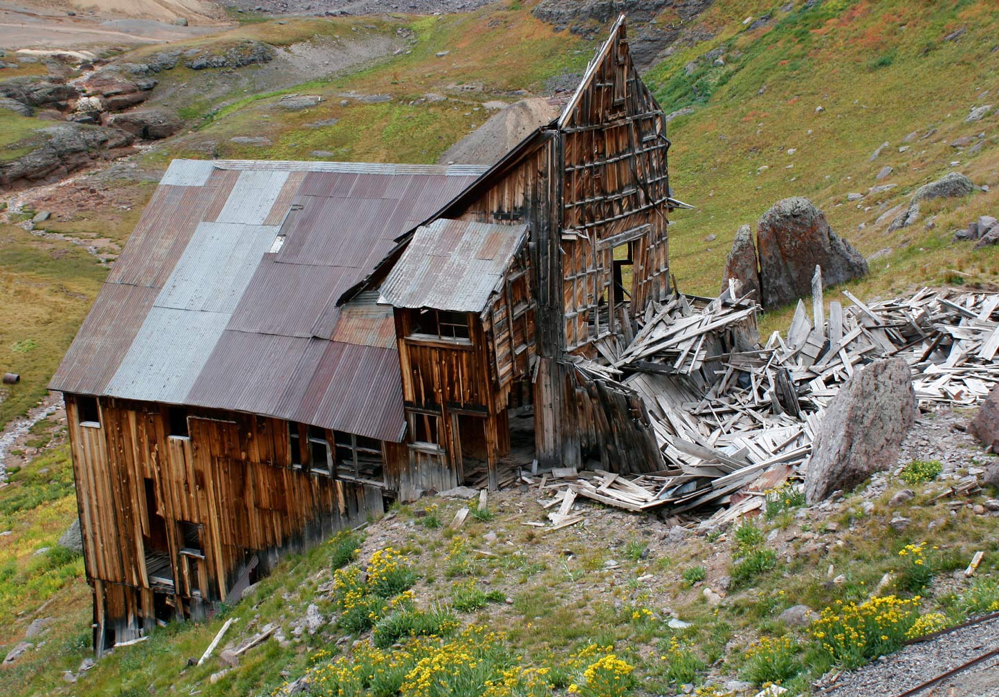
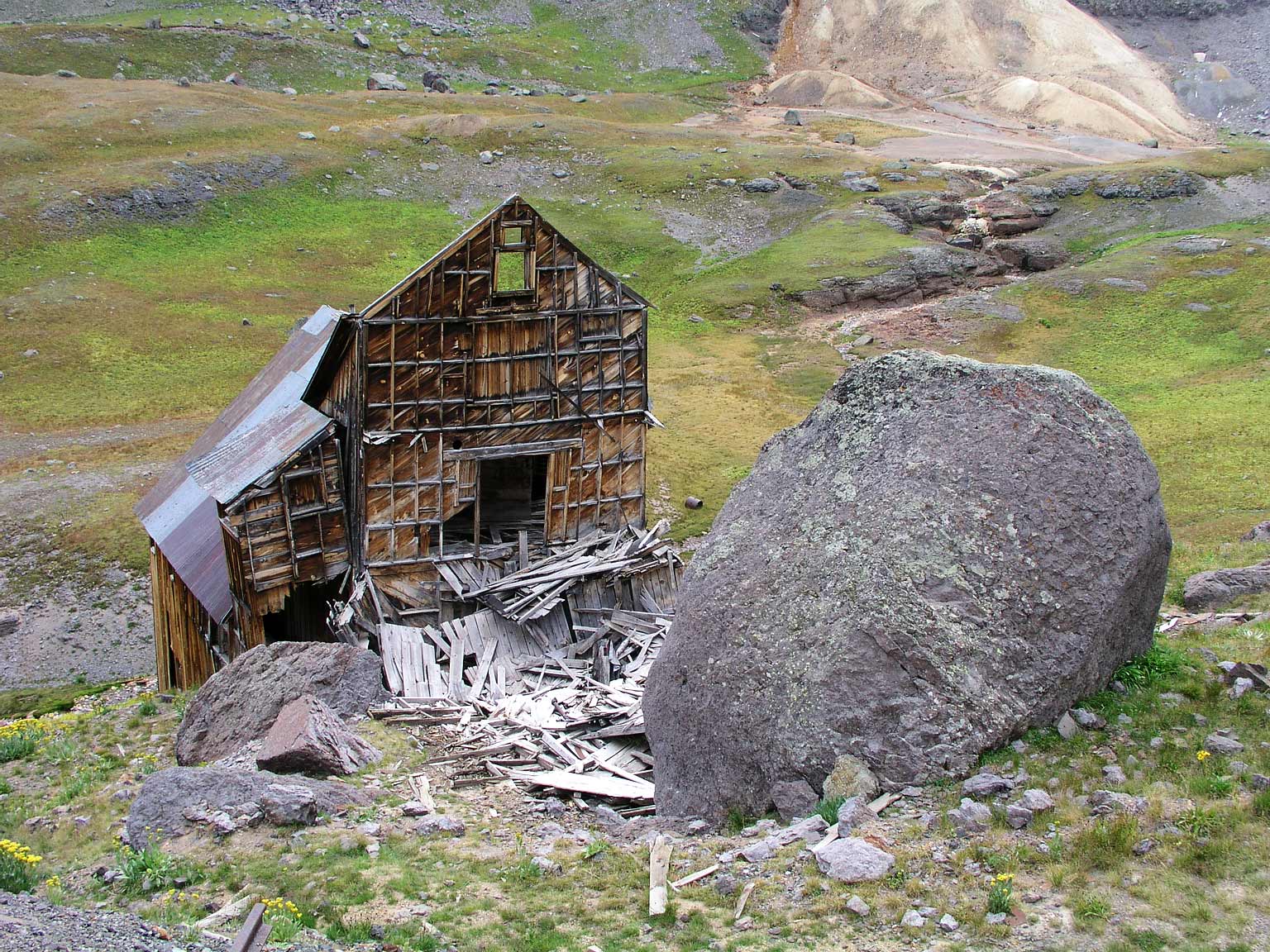
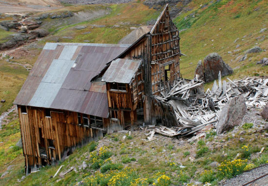
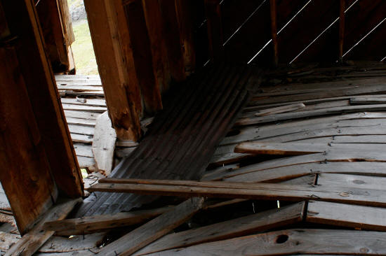
View of Mountain Top Mine building debre with St. Sophia Ridge on horizon.
Approximately half of this building has completely collapsed and is represented in the pile of wood in this image.
7
|
 |
View looking east from above the Mountain Top Mine bunkhouse.
Many of the rocks in this area are car or house size.
8
|
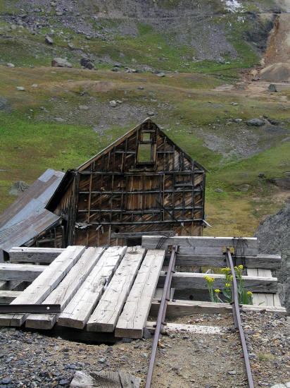 |
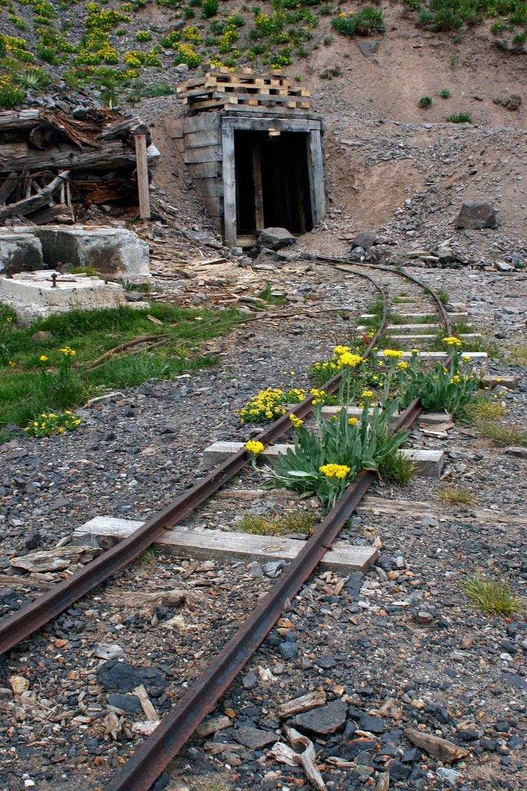
End of ore cart rails from the mine. The ore cart tipple would
have been located at the end of the rails. If there was a stamp
mill in the ruins of the building below the ore would have been
crushed for further processing.
9
|
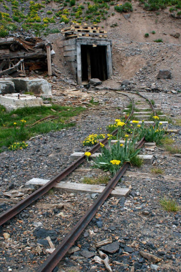 |
The ore cart rails as they curve toward the main mine shaft.
10
|
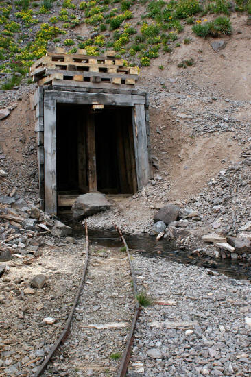 |
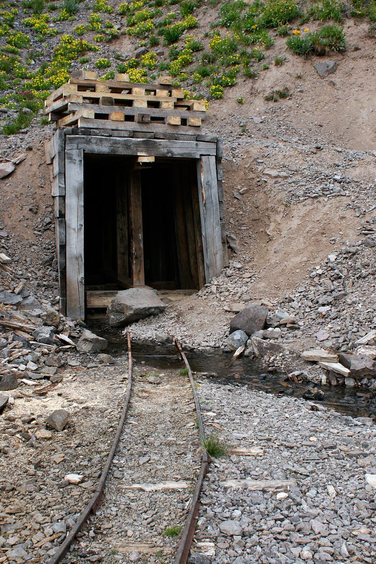
The ore cart rails as they enter the mine shaft.
11
|
 |
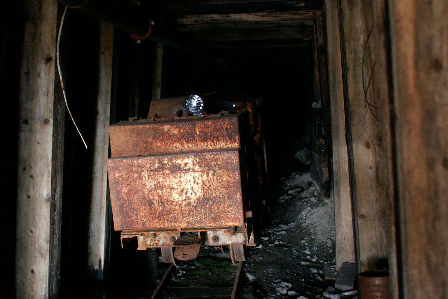
View inside the mine at what appears to be an ore cart in fairly good condition
with a new lamp.
12
|
 |
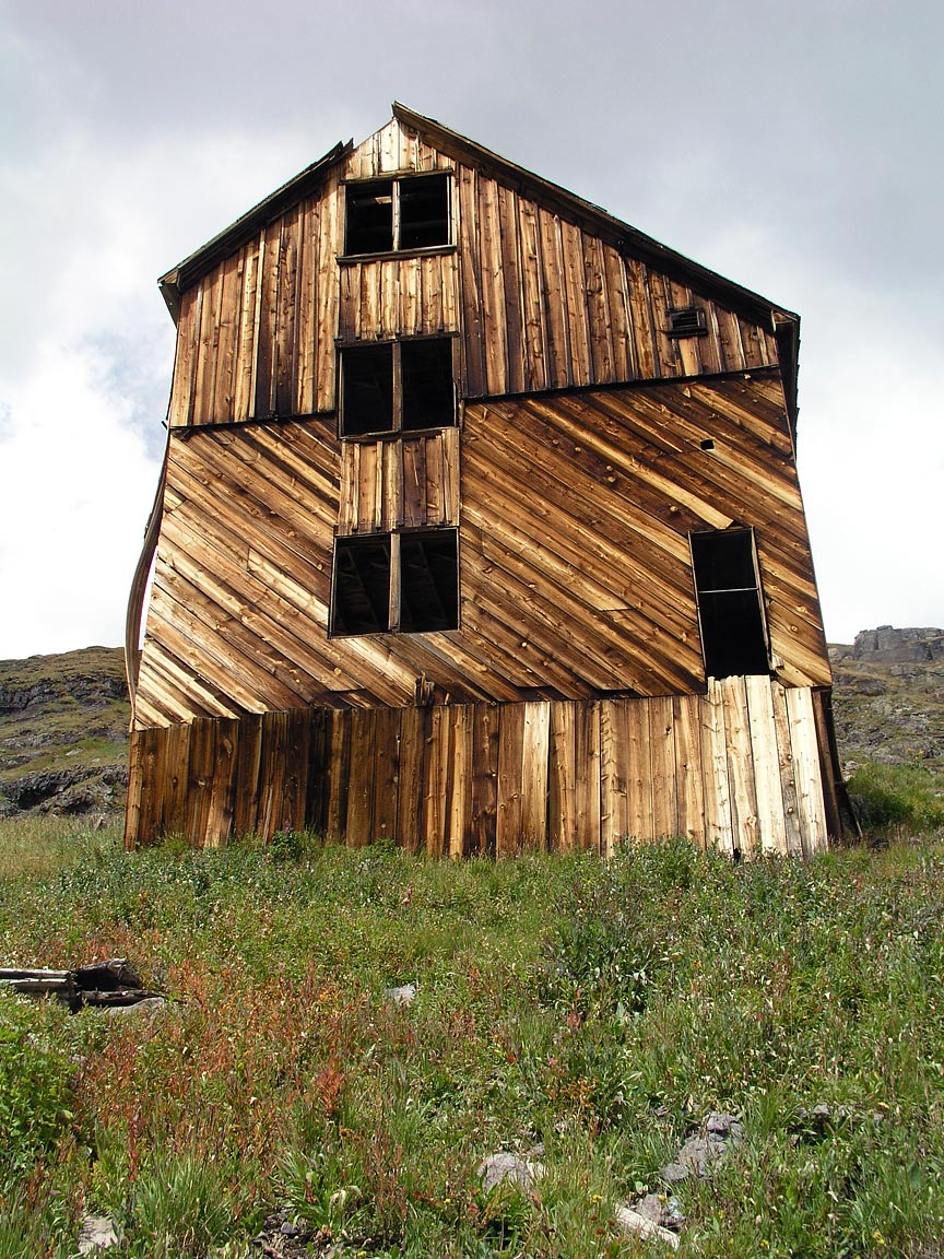
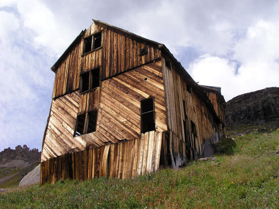
View of the south elevation of the miners living quarters or bunkhouse.
13
|
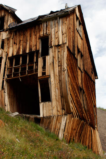 |
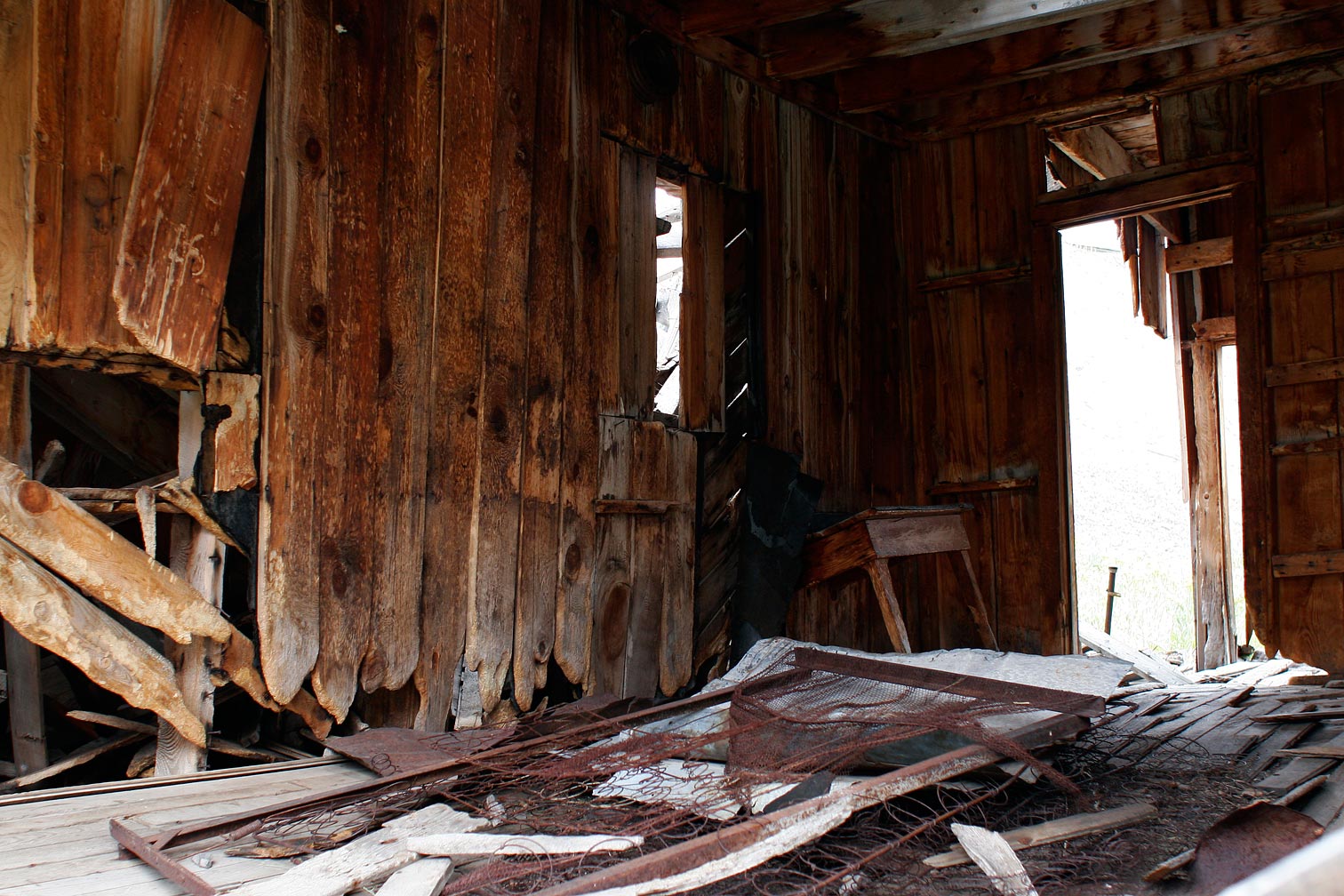
This image clearly shows the weak point in this building were the foundation supports
meet the floor framing for the lowest functional areas in the building. This entire corner of the building could blow-out under pressure from snow or heavy wind load. The building
is not cabled in any way so it will be a pile of rubble very soon unless something is done to stabilize the southeast corner.
14
|
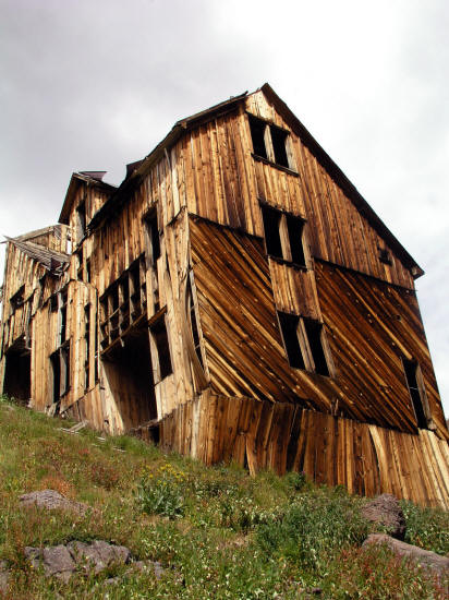 |
View from farther down the very steep grade of the south and east elevations of the bunkhouse.
Another very clear view of the weak condition of the building in this
location.
15
|
 |
View of the east elevation of the bunkhouse.
16
|
 |
View of the northeast corner of the bunkhouse.
17
|
 |
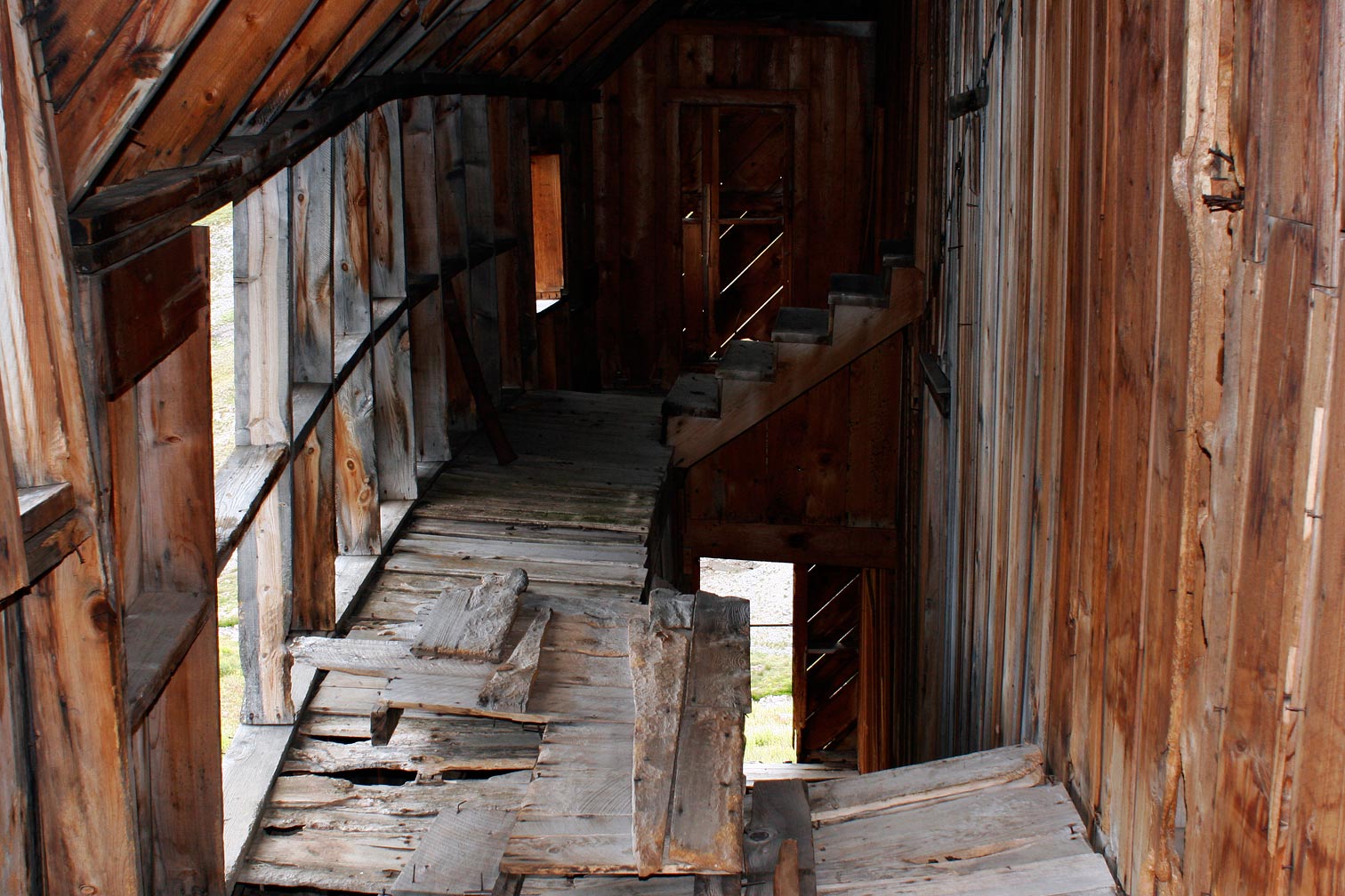
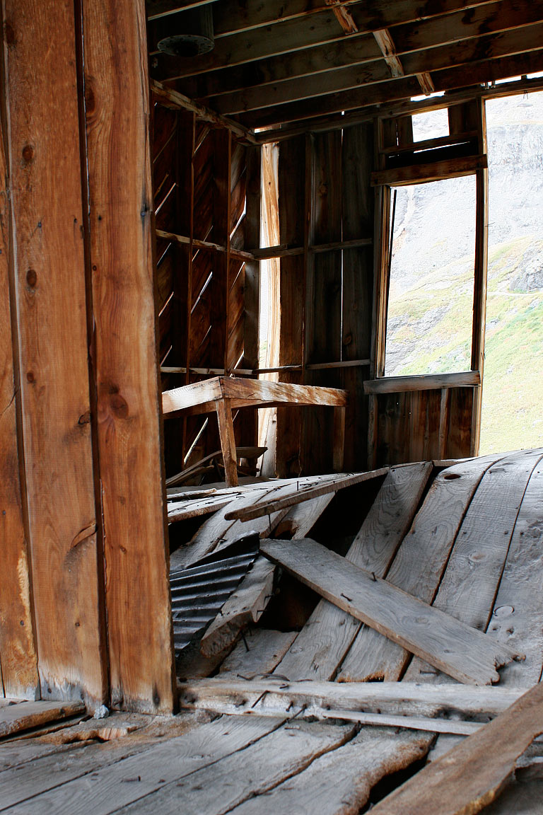
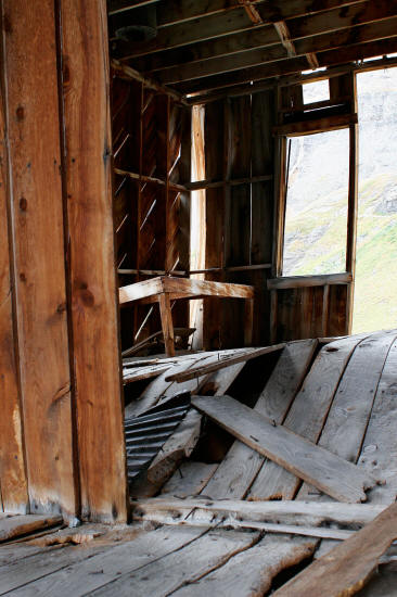
This is a view of the interior of the bunkhouse in what must have
been a stair system and connectiong landings. The windows on the
left of the image are on the north elevation.
18
|
 |
This is another interior view of the bunkhouse with the rusting
remains of an old box springs and mattress.
19
|
 |
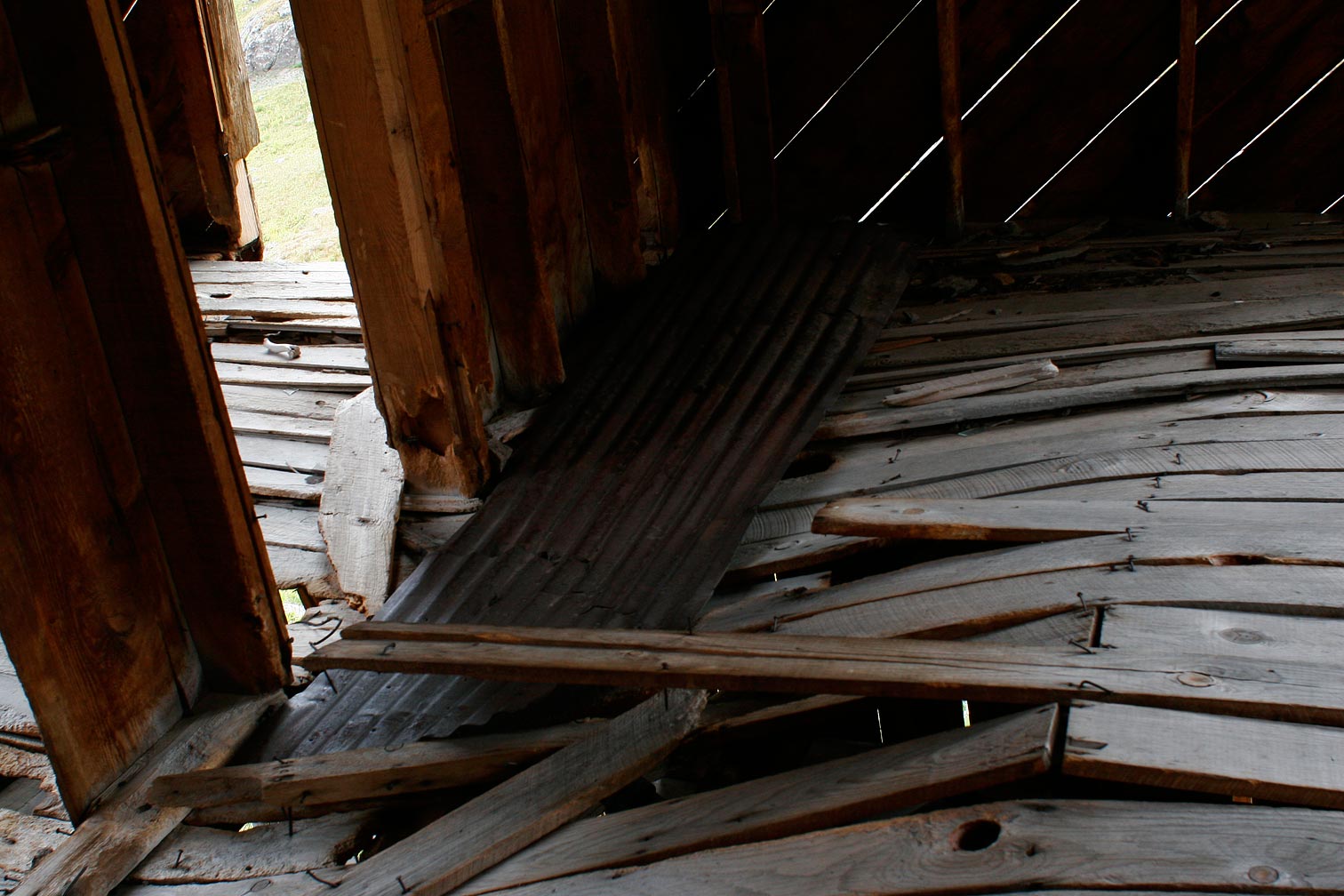
This view shows the stress the floor boards in the building are under
due the the fact the the bulding is being torqued in several directions
and pushed off it's foundation.
20
|
 |
This view shows extreme bending in the floor boards at one of the
living quarters areas in the building.
21
|
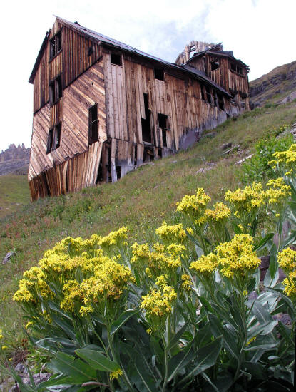 |
A view of the northeast corner of the building and yellow
wildflowers.
The yellow wildflowers are Black Tip Scenecio.
22
|
 |
View of north elevation.
23
|
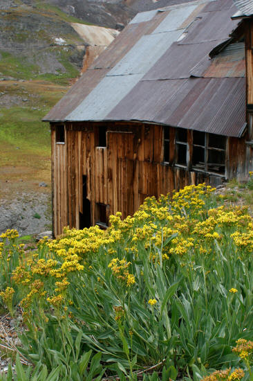 |
Black Tip Scenecio wildflowers and the north elevation.
24
|
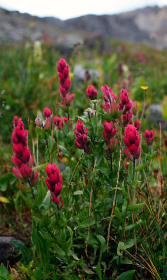 |
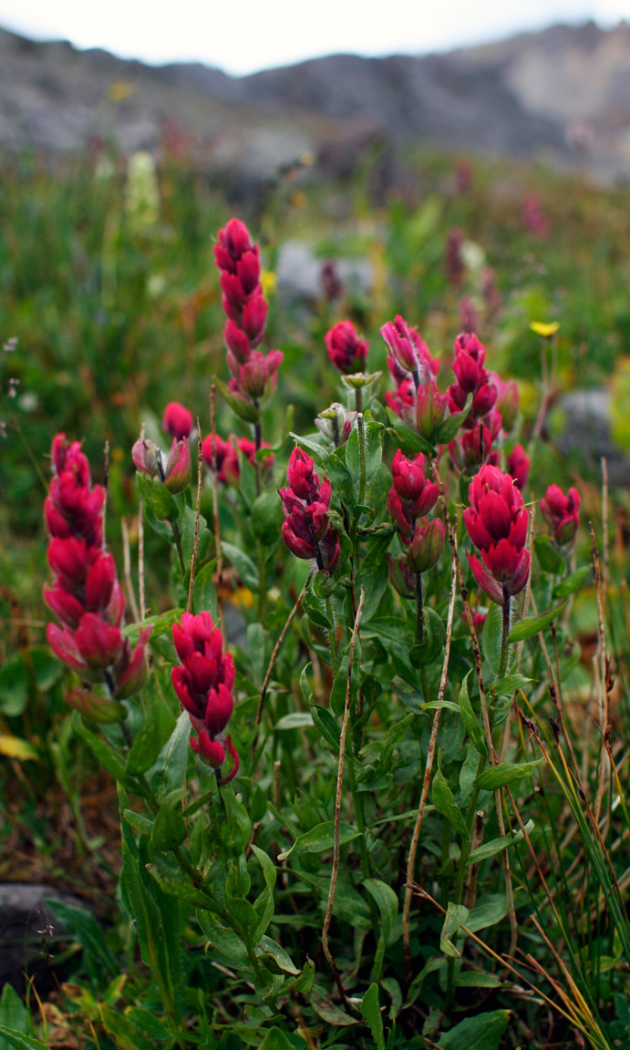
Ruby colored Indian Paintbrush in Governer Basin near the Mountain Top Mine.
25
|
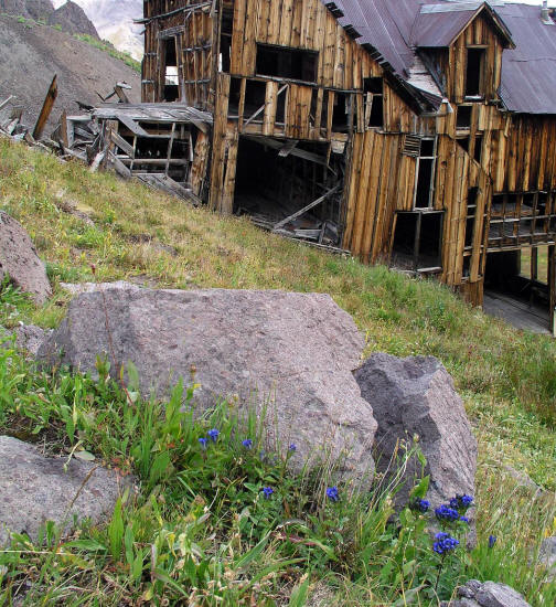 |
Blue wildflowers and the south elevation of the living quarters and
bunkhouse. The blue wildflowers are a blue short variety of Jones
Penstemon.
26
|
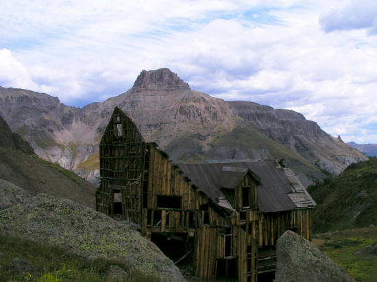 |
View northeast of the Mountain Top Mine bunkhouse and Potosi Peak.
27
|
 |
View south from the Mountain Top mine site to the access road in
Governor Basin.
28
|
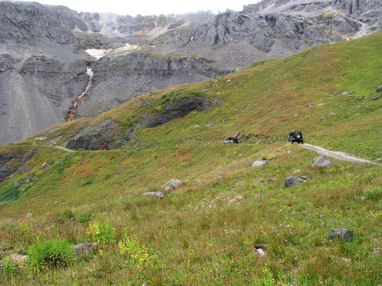 |
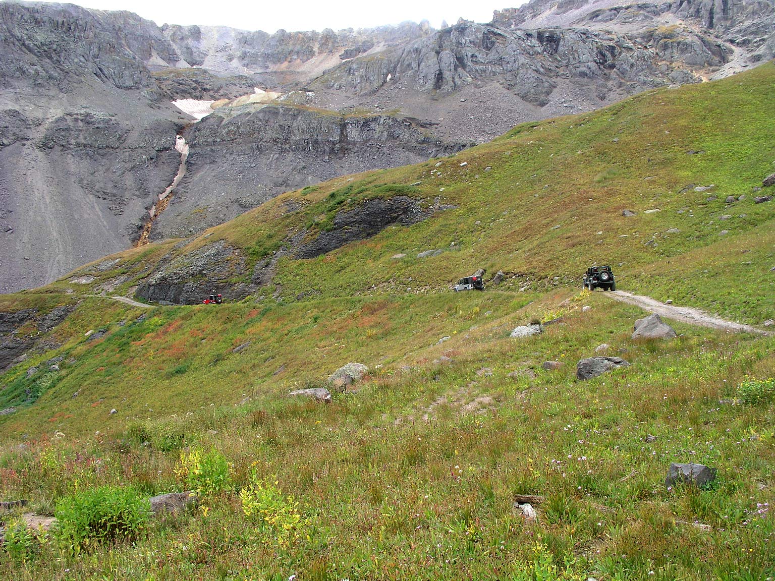
Three jeeps returning from a visit to the Mountain Top Mine.
29
|
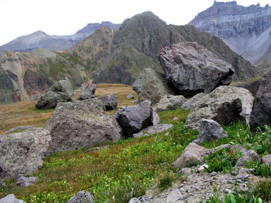 |
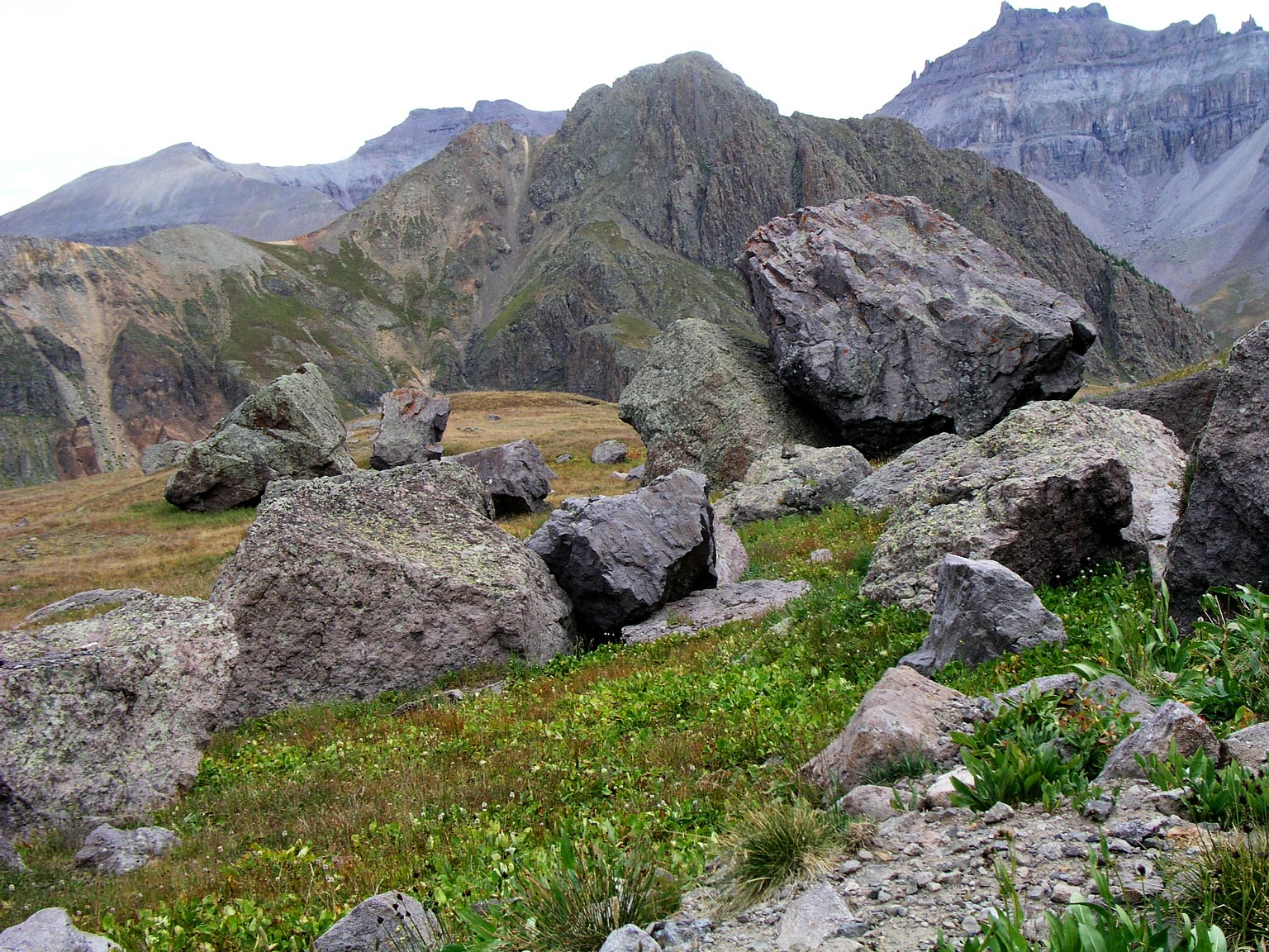
Massive boulders along the access road in Governor Basin. View
is generally north with Stony and Teakettle
Mountain in the
background.
30
|
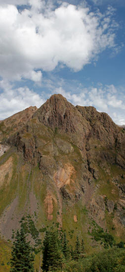 |
Panoramic vertical view of Stony Mountain from the Governor Basin
access road.
31
|
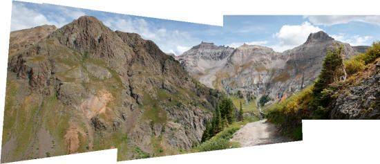 |
Panoramic view looking north from FR 8513C as it approaches tree
line. The altitude is in the range of 11,850'. Stony, Teakettle and Potosi Mountians in the background.
32
|