|
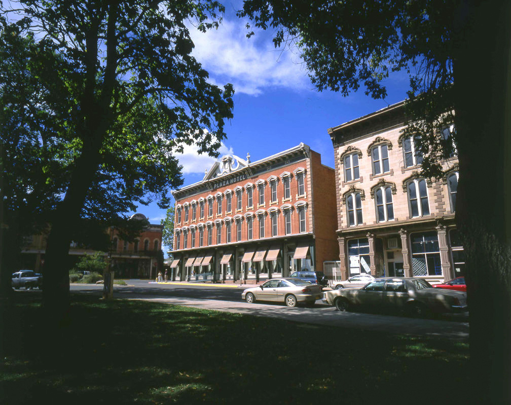
The red brick three story building is "The Plaza Hotel" on "The Old Town Plaza" in Las Vegas, New Mexico.
Las Vegas, New Mexico was a major stop along the Santa Fe Trail. This city, located along I-25 between Santa Fe and
Raton, has over 900 buildings on the National Register of Historic Places.
1
|
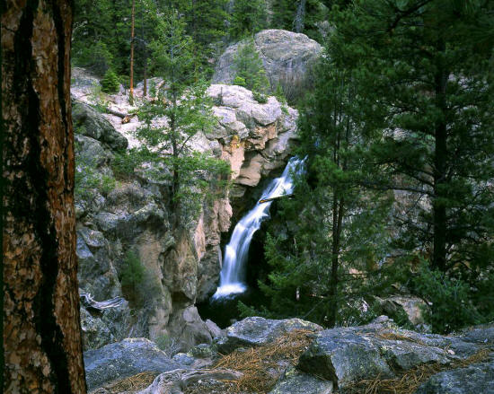 |
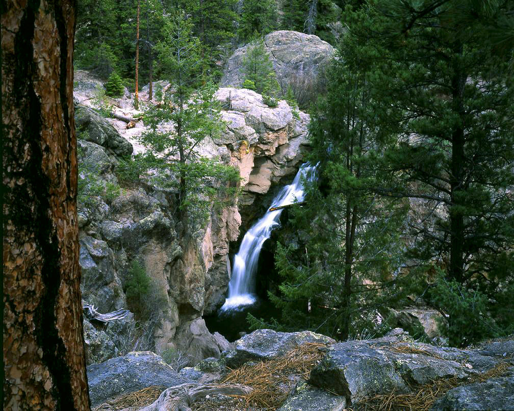
Jemez Falls in the Santa Fe National Forest on the Jemez River in central New Mexico. The falls are located at 7800
feet above sea level in the Jemez Mountains and drop 70 feet in a series of cascades. This view is from a cliff side overlook about half
mile from Jemez Campground.
2
|
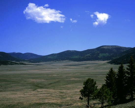 |
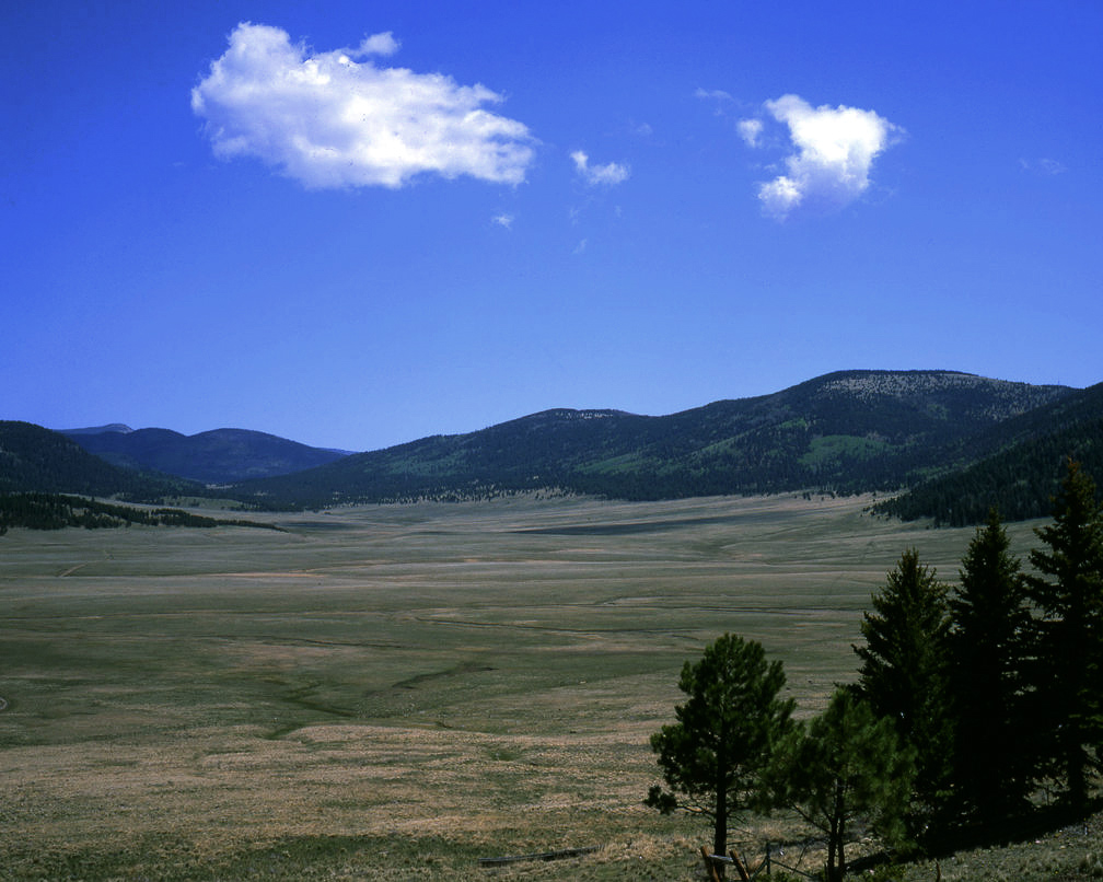
Looking northeast, this image was taken from Hwy 4 on the eastern edge of "Valle Grande" a high mountain meadow that is part of
Valles Caldera National PreserveThis image does not do justice to this very beautiful and expansive
open space.
Fall color in Valles Caldera.
3
|
 |
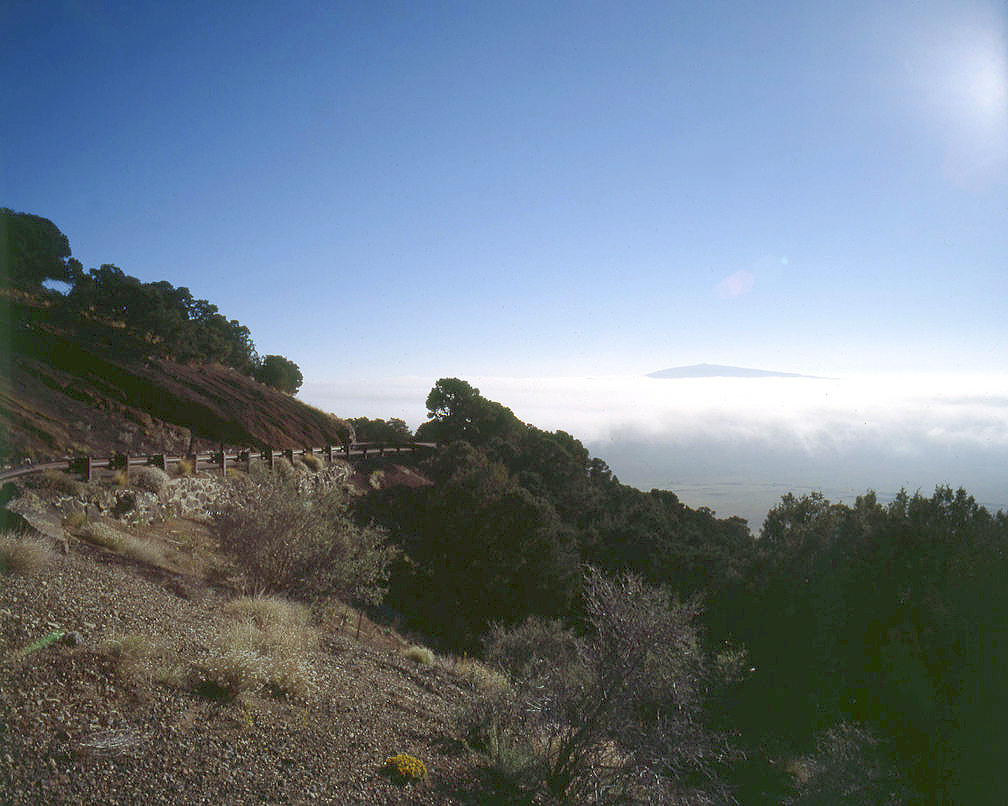
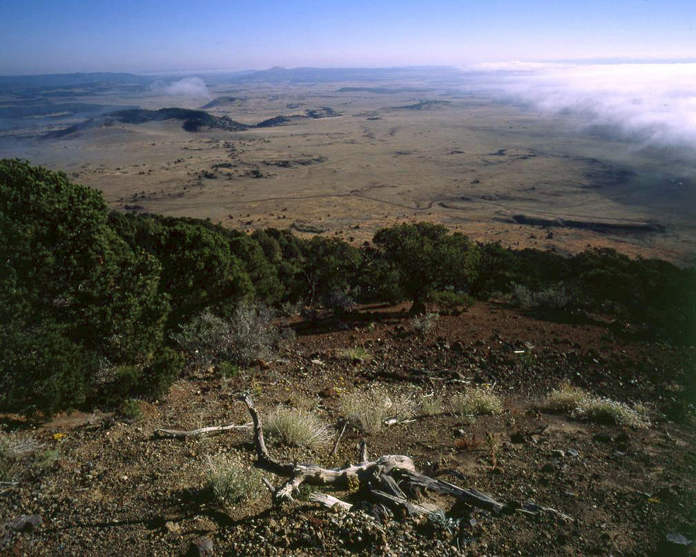
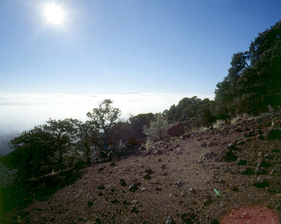
Capulin Volcano National Monument near Raton, New Mexico. This image, high on the
volcano, shows the access road that winds two miles to the top of the crater. The view is north. The peak on the horizon piercing the clouds
is Robinson Peak.
4
|
 |
View is northeast from along the access road overlooking the adjacent volcanic fields. The remnant volcano in the distance
just below the horizon on the left side of the image is named Mudd Hill.
5
|
 |
Another similar image looking northeast taken somewhat lower on the volcano. The volcano is quite steep and the
cinders lie at or near the angle of repose. Mudd Hill also appears in this image.
6
|
 |
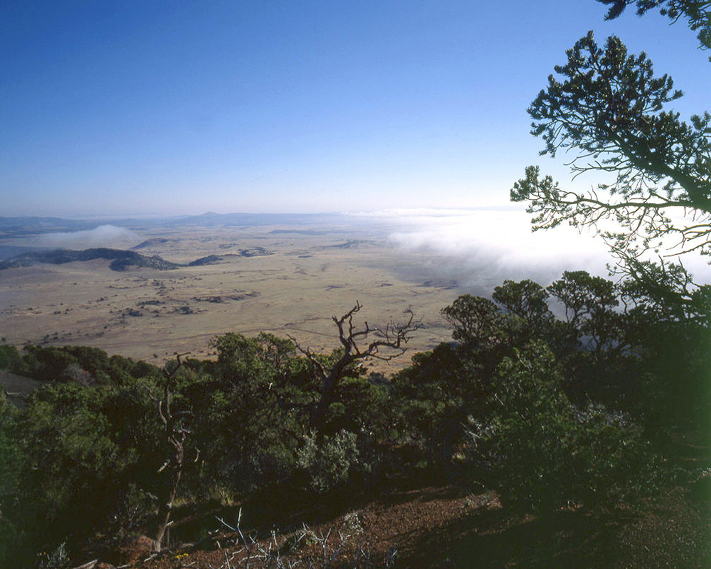
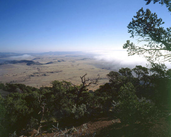
Looking east from above the clouds on the slopes of Capulin Volcano.
Capulin Volcano rises abruptly 1000 feet above the surrounding
plains and volcanic fields of northeastern New Mexico providing expansive
views in all directions.
7
|
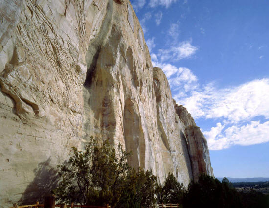 |
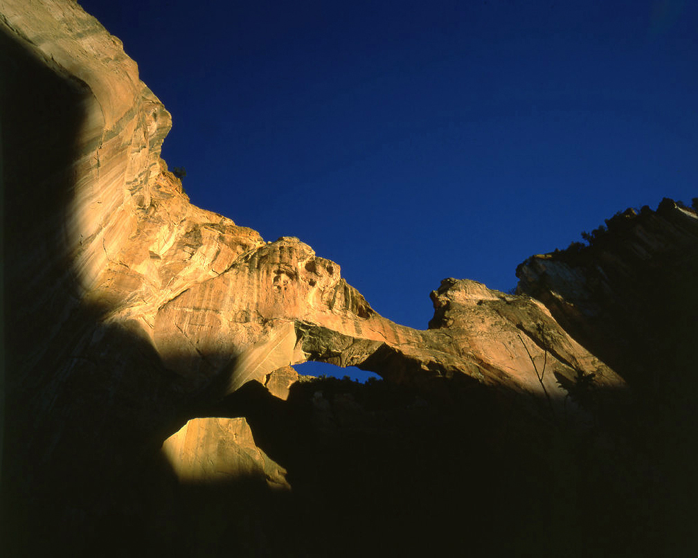
This image is looking west along the north face of Inscription Rock at El Morro National
Monument near Grants, New Mexico. A spring at the base of the massive 200 foot high rock outcrop was a must stop
for centuries as travelers crossed this seasonally dry region. Thousands of passers-by carved initials and messages
in this rock as they rested in it's shade.
8
|
 |
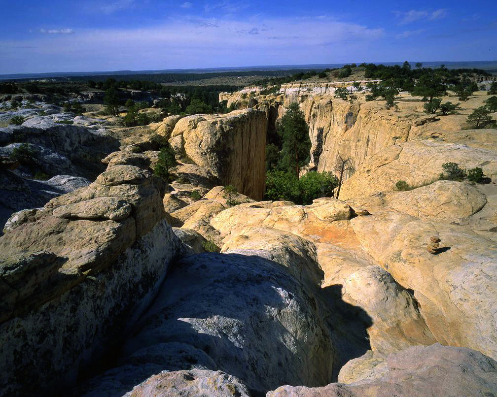
A view generally east from the top of El Morro Rock. This area was named as a National Monument as early as
1906. The National Park Service was not created until 1916. Early in the 20th century before indoor
plumbing was ubiquitous a spring was a magical place.
9
|
 |
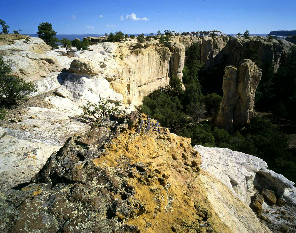
This view is looking to the west from the top of
El Morro toward the position of the previous image. The rock viewed
from the top is composed of both yellow and white sandstone.
10
|
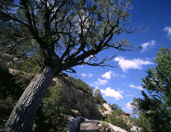 |
This tree along the switchback trail that climbs to the top of El Morro is commonly called an alligator juniper.
11
|
 |
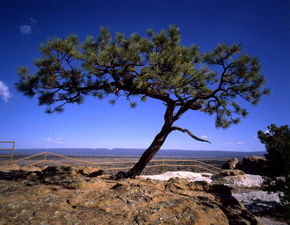
Lone pinyon pine growing out of a crevice in the rock on top of El Morro. The railing is installed at the edge of a vertical drop-off.
12
|
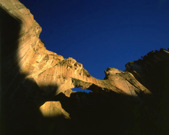 |
View taken from the base of La Ventana Arch at sunset. La Ventana Arch is in El Malpais National Monument near Grants, New Mexico.
13
|
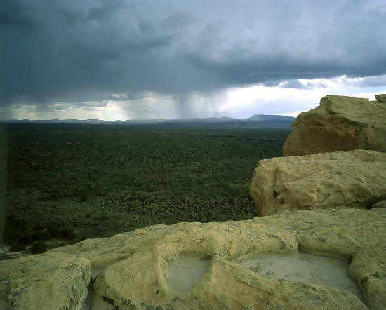 |
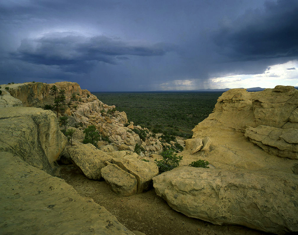
View is looking northwest to a thunder storm from the Sandstone Bluffs Overlook in El Malpais National Monument.
The dark area in the mid ground is the massive El Malpais lava flow.
14
|
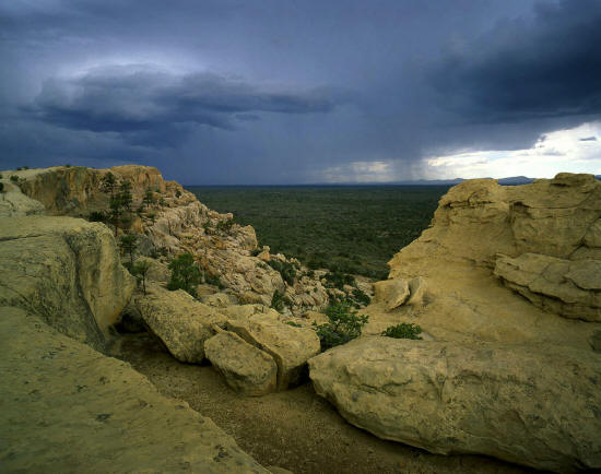 |
View looking southwest from the Sandstone Bluffs Overlook. The line of bluffs runs approximately one mile on the east
side of the lava flow. Access is south from Hwy 117 off I-40 near Grants, New Mexico.
15
|
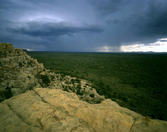 |
Another similar view southwest.
16
|
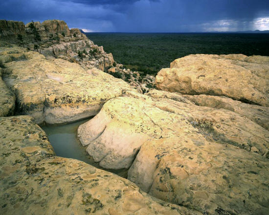 |
View southwest includes a water pocket on top of the bluffs.
17
|
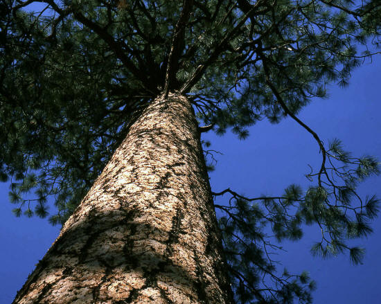 |
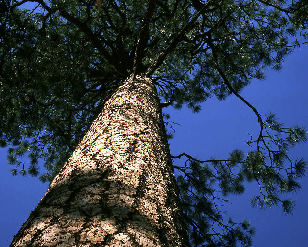
Ponderosa pine along the trail to Upper Frijoles Falls in Bandalier National Monument near Las Alamos, New Mexico.
18
|
 |
Image exhibits very poor light but does show the swiss-cheese like rock formations that occur
in several locations along the trail to Upper Frijoles Falls. This kind of rock is a type of eroded
volcanic tufa and it occurs throughout Frijoles Canyon.
19
|
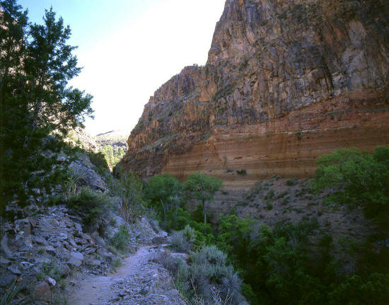 |
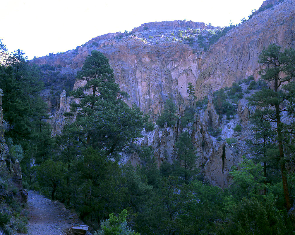
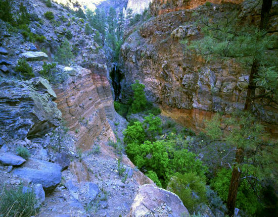
Another view along the trail looking up canyon toward Upper Frijoles Falls. The canyon walls are close and
several hundred feet high on both sides of the canyon near the falls.
20
|
 |
Another view along the trail looking up canyon toward Upper Frijoles Falls.
21
|
 |
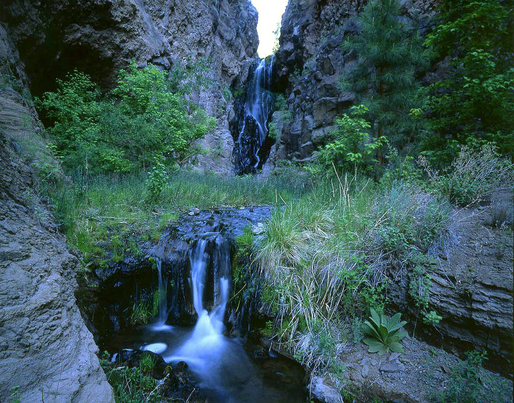
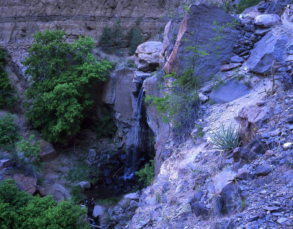
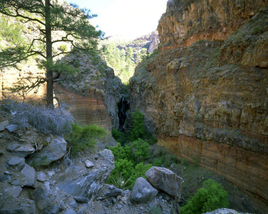
Close-up of Upper Frijoles Falls from just below the trail. This is a rugged area. Frijoles Creek has
carved out a very narrow and deep canyon composed of very loose rock.
22
|
 |
View to Upper Frijoles Falls from a small cascade along Frijoles Creek in this very narrow section of Frijoles Canyon.
23
|
 |
View approaching the plunge pool at Upper Frijoles Falls.
24
|
 |
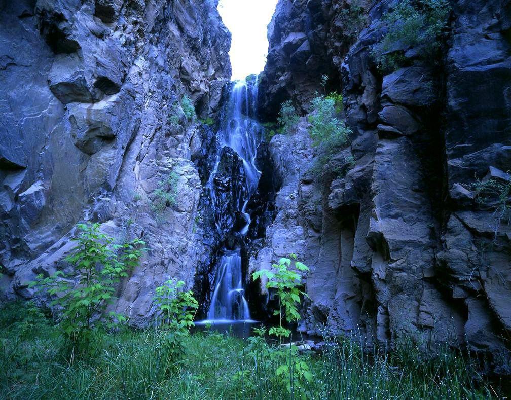
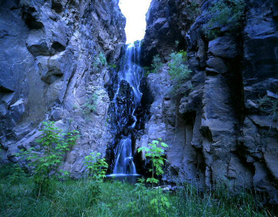
View of Upper Frijoles Falls from the plunge pool. This falls is more of a cascade than a freefall waterfall.
Standing in this location was pretty dramatic. The falls drop in the range of 60 to 70 feet. The surrounding
canyon walls are several hundered feet high and very close and narrow.
25
|
 |
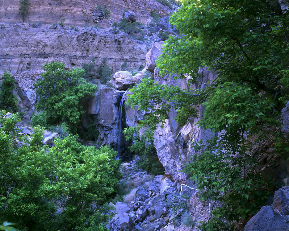
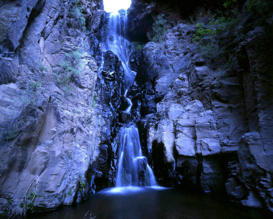
View of Lower Frijoles Falls from the access trail. Lower Frijoles Falls is a little over one-quarter mile farther
down canyon from the upper falls. This falls is not as large as
Upper Frijoles Falls, however it is a freefall waterfall as opposed to a
cascade. After a heavy rain both falls would be dramatic.
26
|
 |
Another closer view of Lower Frijoles Falls from the access trail. The hike to both falls is a very fine four
mile round trip hike. The trail becomes more dramatic as it approaches
Upper Frijoles Falls. It is mostly downhill on the way in, uphill on
the way out and exposed to the sun much of the way.
27
|